YAMA-OTAKU
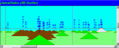
View from Mt. Akadake drawed by 'Jama-otaku' (JDK Version)
'YAMA' means mountain, and 'OTAKU' means a maniac.
This is the oldest software for moutain view. Original version is developed by VERDE(Mr. Sunami) before Windows came out in NEC PC9801 Dos. Now this software can operate on Windows, Macintosh and Java(JDK1.1).
Many men (including me) bought personal computers in order to operate only this software.
Mountain images generated by this software is not realistic but a simple triangle as above.
But its operating is so light. And heigh cost digital data is not necessary for this software.
It is only text data composed by name of moutain, latitude, longitude and height, to operate YAMA-OTAKU.
And data for this is easy to make, and the data of this, if you are willing to do, make much minute than digital map, because we make this data by ourselves.
The data of this software is collecetd in 'FYAMAP CD-ROM' and its library.
Java test version is here. Englsh version is developed.
Long time passed by from the software came out to us, but we always approciates it.
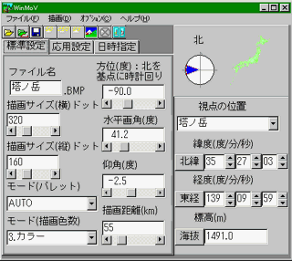
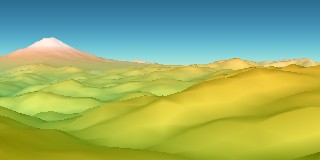
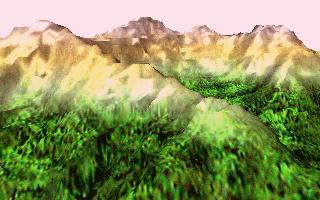 Mt.Hotaka rendered by CHsystem using original data.
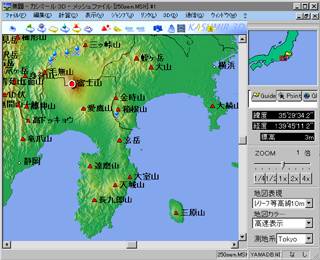 Kashmir, as you know, is a freesoftware developped by DAN Sugimoto. Its fantastic facility will enchant you.