MAKE SKETCHES WITH MoV
Kragen偝傫偺捁嵴恾嶌惉僜僼僩俵倧倁偵偼堄奜側婡擻偑朙晉丅嵟嬤偺寙嶌婡擻偑偙偙偱偛徯夘偡傞乽僗働僢僠晽乿昤夋偩丅敀崟側偺偱夋憸僒僀僘傕摉慠彫偝偄丅
MoV is a freesoftware which can draw a bird's -eye view with Japanese digital map(50m/250m/1km grid) and USGS, developed by Kragen. This software provides many type of drawing. One of my favarite type is 'sketching mode' that is used for following images. This type of drawing generates black-and-white image, so file size is smaller than others.
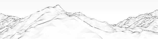
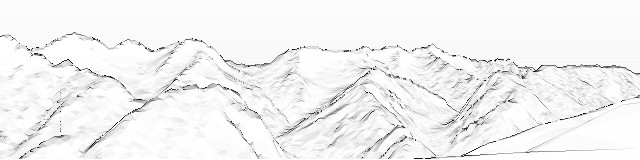
 杒曚崅妜偐傜偺憚丂Mt.Yari view from Mt. KitaHotaka(22KB)
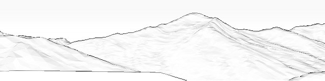
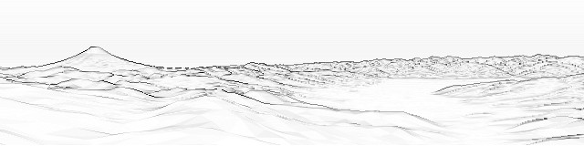
慶晝妜偐傜偺崟晹屲榊妜丂Mt. Kurobegorou view from Mt. Gii(18KB)
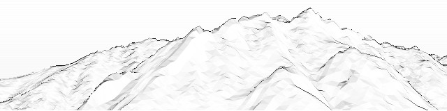
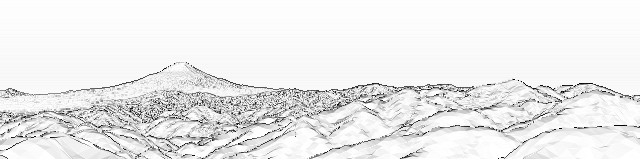
摽杮摶偐傜偺慜曚崅丂Mt. MaeHotaka view from the Tokugou Pass(24KB)
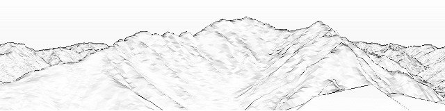
夃戲妜偐傜偺曚崅丂Mt. Hotaka view from Mt. Kasumisawa(28KB)
挶儢妜偐傜偺憚曚崅丂Mt. Yari & Mt. Hotaka view from Mt. Chou(28KB)
扥戲丒搩儢妜傛傝丂View from Mt. Tou (in Tanzawa)(29KB)
戝曥嶧摶傛傝 View from the Daibosatsu Pass(20KB)
嶰僢摶嶳傛傝 View from Mt. Mitsutouge(22KB)
偐偮傜偓嶳捀揥朷岞墍墂傛傝丂View from the station of the Prospective Park at the top of Mt. Katsuragi (Izu Pref)(19KB)
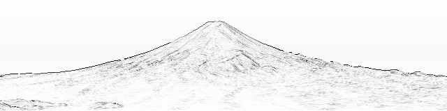
帄暓嶳傛傝鄿儢妜丂Mt. Hiuchi view from Mt. Shibutsu (Oze)(24KB)
丂偙偺儁乕僕偺夋憸偼崙搚抧棟堾姧峴偺悢抣抧恾丄俀俆侽倣儊僢僔儏丄俆侽倣儊僢僔儏乮昗崅乯偍傛傃俥倄俙俵俙俹偺晹暘悢抣抧恾僨乕僞傪棙梡偟偰丄Kragen偝傫嶌惉偺俵倧倁偵偰嶌惉偟傑偟偨丅
丂Images in this page generated by Mov which developed by Kragen, with '50m Grid (Elevation) Data' and '250m Grid (Elevation) Data' provided by the GSI of Japan, and also uses the free digital height data provided by FYAMAP.
|TOP|Vistapro|Kashmir|OLD CG