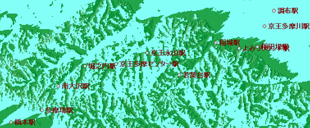
| staion | latitude | longituide | height(m) | visible? | comment | |
| Chofu | 35.38560 | 139.32487 | 36.0 | O ? | ||
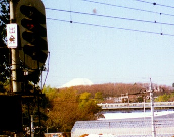
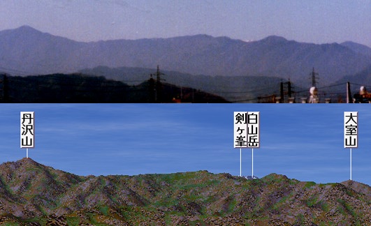
| Keio-Tamagawa | 35.38274 | 139.32222 | 30.0 | O | photo & CG | |
| Inadatutumi | 35.37502 | 139.32034 | 29.0 | X | CG of invisible | |
| Yomiuri-land | 35.37469 | 139.31131 | 38.0 | X | ||
| Inagi | 35.37577 | 139.30079 | 48.0 | possibly X | ||
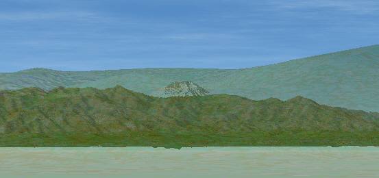
| Wakabadai | 35.36585 | 139.28284 | 81.0 | O | PHOTO | |
| Nagayama | 35.37385 | 139.27010 | 79.0 | X | ||
| Tama-center | 35.37181 | 139.25347 | 86.0 | X | ||
| Horinouchi | 35.37149 | 139.24095 | 101.0 | O | Image by Kashmir | |
| Minami-oosawa | 35.36379 | 139.22562 | 113.0 | posibly invisible | ||
| Tama-Sakai | 35.35535 | 139.22118 | 128.0 | O | Image by Kashmir | |
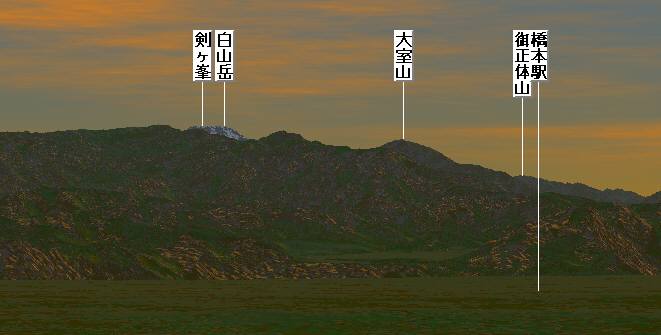
| Hashimoto | 35.35318 | 139.20471 | 141.0 | O | PHOTO & CG PHOTO CD(91KB) PHOTO CD16X(50KB) |
Fuji visible map --- Odakyu Tama Line
Link for rerations
'Train heading for Mt.Fuji' by Mr. YoichiOdakyu Keio
Keio Teito Dentetsu Its timetable, audio of train