Fuji visible map -- Odakyu Tama line
Japanese
Visible are is painted sky-blue. This page uses Javascript that can't operate at Microsoft IE3. You can see a dialog about the station (painted red ), if only your mouse move to the mark. This image map is generated by Kashmir useing of 'Nippon2' (50m grid (elevation) data) provided by the GSI of Japan. The data of border of prefectures is provided by Mr. Shuichi Niida.
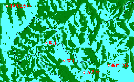
The location of the stations in Tama line of Odakyu (except Tama-center, Karakida)
|
|
| station | latitude | longitude | height(m) | visible? | comment |
|
Odakyu Nagayama | 35.37369 | 139.27006 | 85 m | X | |
|
Kurokawa | 35.36368 | 139.28246 | 85 | O | photo
|
|
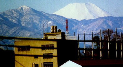
Kurihira | 35.36092 | 139.29034 | 76 | O | photo
|
|
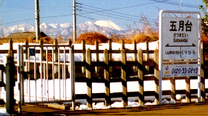
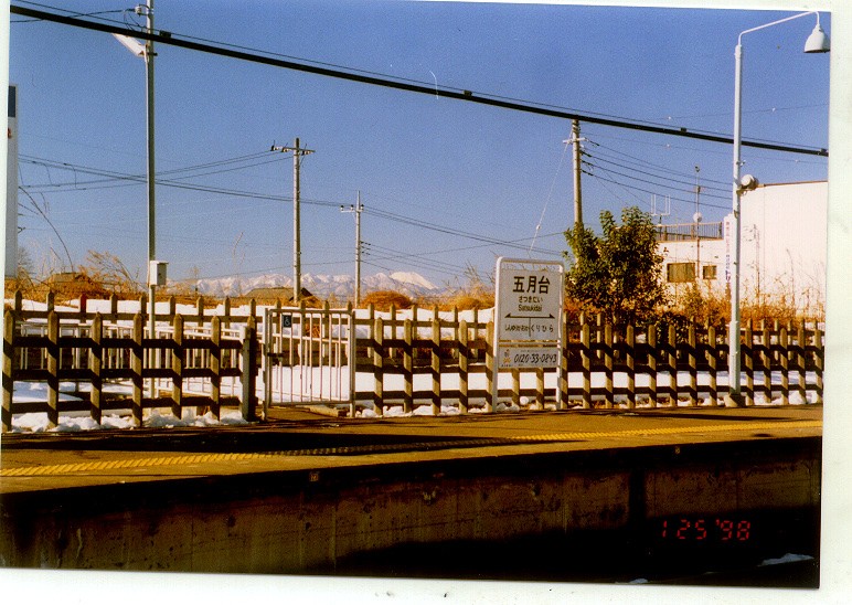
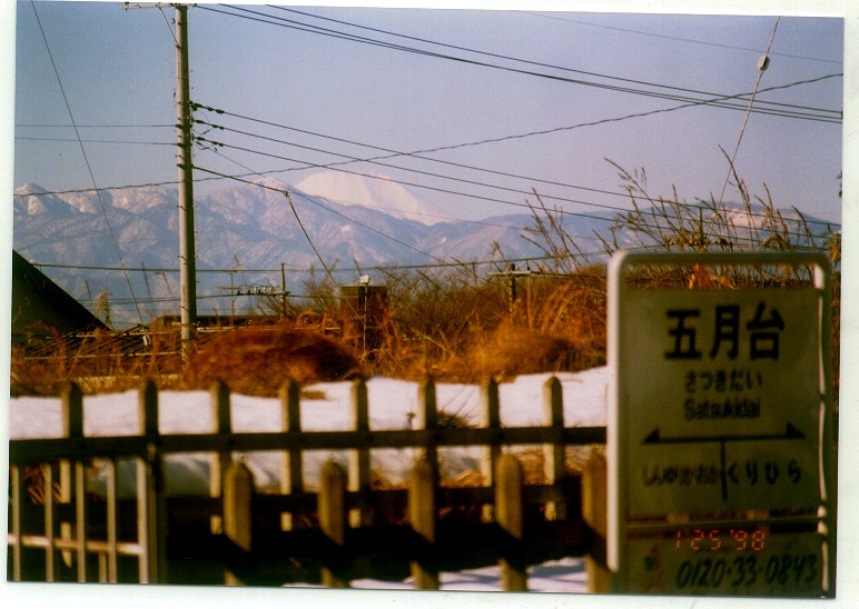
Satsukidai | 35.35500 | 139.29455 | 60 | O | photo
70mm(150KB)
300mm(112KB)
|
|
Shin-Yurigaoka | 35.36015 | 139.30386 | 62 | O | |
|
|
Fuji visible map in Keio-sagamihara line
Link for relations
'Trains heading for Mt. Fuji' by Mr. Yoichi Odakyu